Surveying (Geomatics) (SURVY) Courses
SURVY 300 Elementary Surveying
- Units:4
- Hours:45 hours LEC; 81 hours LAB
- Prerequisite:None.
- Advisory:MATH 373 with a grade of "C" or better
- Transferable:CSU; UC
- General Education:AA/AS Area II(b)
- Catalog Date:August 1, 2024
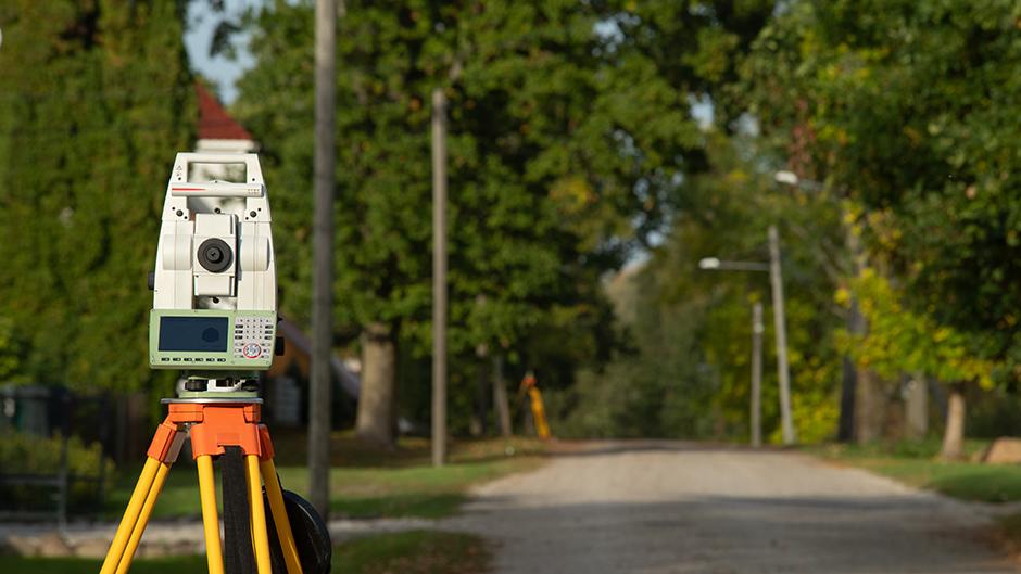
This course provides an introduction to the principles and practices of plane surveying. Survey instrumentation and methods of measuring distances, angles, and differences in elevation will be presented. Fundamental surveying methods including traversing, survey computations, and use and care of electronic survey equipment will be covered.
Upon completion of this course, the student will be able to:
- select appropriate survey equipment for a specific task; operate, maintain, and check it while completing a typical surveying assignment.
- interpret, collect, analyze, and present data needed to complete various types of survey and mapping projects
- create an orderly formatted, organized, logical presentation of surveying problems and their solutions in accordance with standards of surveying practice.
- apply consistently logical and methodical measurement techniques in acquiring and furnishing survey data and measurements.
- summarize the survey professions functions and services, and describe its relationship to other industries and society in general.
- demonstrate knowledge of statutory authority and responsibilities of a professional land surveyor.
SURVY 310 Survey Map Production
- Units:4
- Hours:45 hours LEC; 81 hours LAB
- Prerequisite:EDT 310 with a grade of "C" or better
- Transferable:CSU
- Catalog Date:August 1, 2024
This course provides an exposure to the special procedures and requirements unique to computer-assisted survey mapping. Fundamental survey drafting methods and types of maps will be stressed. Conformance with local agency and State of California mapping requirements will be addressed. Students will work with state of the art computer hardware and software to produce industry standard survey maps.
Upon completion of this course, the student will be able to:
- demonstrate proficiency using Computer Assisted Drawing (CAD) work station hardware to produce survey drafting/design work.
- access appropriate AutoCAD commands by using the following; a.) tool bars; b.) pull-down menus; c.) keyboarding; d.) the mouse.
- define how the AutoCAD program is structured and is adaptable to various survey industry mapping procedures.
- identify and employ appropriate construction and positioning commands required for geometric layout and construction of surveying related mapping.
- select appropriate mapping media and textual expression in conformance with current industry standards and statutory mapping standards.
- narrate surveying computational processes to provide and check for accurate survey information for map creation.
- demonstrate proficiency in using various AutoCAD commands and settings by establishing or creating the following: a.) units and sheet size; b.) layers, line types, and colors; c.) precise geometric entries; d.) dimensioned drawings; e.) stored drawing elements; f.) saved drawings; g.) plotted drawings.
- outline State and local agency survey mapping standards for production of all types of survey maps in conformance with current industry standards.
SURVY 320 Advanced Survey
- Units:4
- Hours:45 hours LEC; 81 hours LAB
- Prerequisite:SURVY 300 with a grade of "C" or better; or equivalent.
- Advisory:MATH 373 with a grade of "C" or better
- Transferable:CSU
- Catalog Date:August 1, 2024
This course focuses on real-world surveying applications such as primary control, construction layout and staking, horizontal and vertical curves, above and underground structural staking, subdivision lotting, and street improvement construction. Introduction to boundary surveying and photogrammetric surveys, California State Plane Coordinate System, and theory of geodetic and control surveys. GPS, GIS, and electronic surveys and mapping are also introduced. Students will need a hand-held electronic scientific style calculator equipped with trigonometric capabilities.
Upon completion of this course, the student will be able to:
- choose correct field and office procedures for control, layout, and boundary surveys.
- assist in complex surveying operations to locate or define horizontal and/or vertical positions, directions of lines and distances between points and locate or delineate property boundaries.
- summarize procedures for the basic structure and purpose of the United State Public Lands Survey System.
- apply principles of the basic structure and operation of the California State Plane Coordinate System.
- evaluate, analyze, and adjust data obtained from survey operations to assure conformance with project specifications.
- assist in conducting a topographic survey, and generate a topographic map from field data captured by a topographic survey.
- understand and comply with regulations of the California Board of Registration of Professional Engineers and Land Surveyors in pursuing licensure as a Professional Land Surveyor.
- discuss surveys for the location and control of alignment and grade for construction of underground, surface, or aboveground structural facilities, including design and layout of horizontal and vertical highway curves.
- describe basic structure of the satellite constellation and operation of the Global Positioning System (GPS) and Global Navigation Satellite Systems (GNSS).
- measure and record astronomical data to determine the true meridian for a survey project.
SURVY 324 Global Positioning Surveying (GPS)
- Units:3
- Hours:36 hours LEC; 54 hours LAB
- Prerequisite:SURVY 320 with a grade of "C" or better
- Transferable:CSU
- Catalog Date:August 1, 2024
This course is an introduction to the methods, techniques, tools, and applications of GPS for use in Land Surveys. It will also present factors of geodesy for surveying, enabling the student to understand and use the mathematical parameters of the earth's shape and effect on survey measurements.
Upon completion of this course, the student will be able to:
- summarize the development of Global Positioning System Surveying (GPS) and its adaptation by the surveying industry.
- set up and manipulate GPS instrumentation in field settings for navigation and survey grade locations.
- recommend appropriate field procedure for horizontal and vertical control surveys utilizing GPS equipment.
- define and illustrate examples of map projection systems and the parameters associated with them.
- compute and convert geodetic and plane coordinates within the various zones of the California State Plane Coordinate System.
- produce the direction of a line and/or establish a meridian by use of GPS survey equipment.
- summarize various uses of GPS surveying instruments.
- reduce, analyze, and compile GPS field data by utilizing post-processing software.
SURVY 330 Special Surveying Projects
- Units:4
- Hours:45 hours LEC; 81 hours LAB
- Prerequisite:None.
- Transferable:CSU
- Catalog Date:August 1, 2024
This course focuses on real world surveying applications, construction control, layout and staking, horizontal and vertical curves, above and underground structural staking, subdivision lotting, and street improvement construction. This course will provide an introduction to boundary surveying and photogrammetric surveys, theory of geodetic and control surveys. Global Positioning Systems (GPS), Geographic Information System (GIS), and electronic surveys and mapping are also included.
Upon completion of this course, the student will be able to:
- correctly select and properly apply procedures for use of surveying equipment for construction layout surveys, control surveys, and boundary surveys.
- evaluate, compile, archive, and disseminate survey data and information through proper written or electronic recording
- act as lead person in complex surveying computation tasks including: determination of horizontal and vertical positions; direction of lines; distances between points; and boundary limits of property ownership.
- define and compute the directions of lines by GPS and/or astronomic methods.
- employ the California State Plane Coordinate System in performing field surveys, data computation, and production of maps.
- under responsible direction, act as lead person in conducting various types of surveys to gather data or locate lines and points.
- under responsible direction, analyze field and record data to prepare a resurvey of public lands.
- under responsible direction and conforming to local agency requirements, prepare a boundary plat from record and measured survey data
- under responsible direction, prepare staking data and a project layout plan for the construction of above and below ground infrastructure.
- pursue certification as a California Land-Surveyor-in-Training.
SURVY 340 Photogrammetry
- Units:3
- Hours:54 hours LEC
- Prerequisite:SURVY 320 with a grade of "C" or better
- Transferable:CSU
- Catalog Date:August 1, 2024
This course focuses on the theory and practice of Photogrammetry, including image systems and quality, theory of stereo photography, and orientation and design of stereo models. The class will also address design and operating principles of stereo plotting and photogrammetric and orthophoto mapping. This course also focuses on considerations for flight and control planning, control identification techniques, advanced field completion surveys, and property line investigations. Study of other remote sensing technologies are included. This courses was formerly known as SURVY 340: Basics of Photogrammetry.
Upon completion of this course, the student will be able to:
- define and illustrate the general principles and applications of photogrammetry.
- compile and define the photographic processes pertinent to aerial mapping.
- recognize the various types of optical systems used in aerial cameras.
- determine and calculate appropriate geometry of various focal lengths and elevations of cameras to conform with terrain conditions.
- identify and demonstrate stereoscopy and its applications to aerial mapping.
- identify specific terrestrial objects, man-made and naturally occurring, using aerial photography identification and interpretation techniques.
- assess and correctly utilize appropriate stereo plotting equipment and instruments.
- compile, appraise, and compute survey ground control and demonstrate flight planning for aerial mapping projects.
SURVY 350 Boundary Control and Legal Principles
- Units:4
- Hours:72 hours LEC
- Prerequisite:None.
- Transferable:CSU
- Catalog Date:August 1, 2024
This course provides instruction in the concepts and legal principles associated with the historic and current practices of surveying and mapping procedures used in locating boundaries and land ownership lines. This course has been developed for those in the fields of surveying, civil engineering, title insurance, and real estate.
Upon completion of this course, the student will be able to:
- summarize the historical development of boundary systems in California.
- evaluate types of land ownership and their effects on transfers.
- describe concepts of sectionalized lands, sequential conveyances, and simultaneous conveyances.
- interpret various types of legal descriptions for land boundary locations.
- analyze the effects of unwritten and senior rights on property surveys.
- identify the concepts of easements, reversions, and riparian rights.
- describe the responsibilities of the professional land surveyor and the guidelines for performance of boundary work.
SURVY 352 Evidence and Procedures for Boundary Location
- Units:4
- Hours:72 hours LEC
- Prerequisite:SURVY 350 with a grade of "C" or better
- Transferable:CSU
- Catalog Date:August 1, 2024
This is a continuation of boundary location with emphasis on procedures rather than principles. It provides an introduction to the historical development, current concepts, and evidence and procedures used in boundary determination. Techniques of gathering and evaluating evidence used in boundary locations and methods of presenting that evidence in the form of maps and descriptions are emphasized. This course is designed for those in the fields of engineering, land surveying, land law, real estate, and title insurance.
Upon completion of this course, the student will be able to:
- summarize the historical development of current common, case, and statutory land law in California and the United States.
- cite concepts, principles, and types of evidence used in boundary determination.
- enumerate types of ownerships and evaluate their effects on transfer of property ownerships.
- interpret and prepare various types of legal descriptions.
- analyze the effects of unwritten title in boundary surveys.
- describe the responsibilities of the professional land surveyor, the court, attorneys, title company, local agencies, and land owners in boundary determination and resolution.
SURVY 360 Survey Business Practices
- Units:3
- Hours:54 hours LEC
- Prerequisite:None.
- Transferable:CSU
- Catalog Date:August 1, 2024
The course provides an introduction to surveying business economics; contracts and specifications; organizing, staffing, hiring, training, and supervision of professional/technical personnel; surveyor-client relationships; and ethics of practice.
Upon completion of this course, the student will be able to:
- identify markets and survey business startup, monthly and yearly costs.
- assess the type of business organization to be used for provision of effective surveying services by a small-medium sized firm.
- prepare a surveying service marketing analysis, marketing plan, strategic plan, and a general business plan.
- apply principles of management and marketing relevant to a surveying business.
- evaluate the importance of records retention along with the attendant legal and ethical implications.
- demonstrate an understanding of organization structures.
SURVY 495 Independent Studies in Surveying
- Units:1 - 3
- Hours:54 - 162 hours LAB
- Prerequisite:None.
- Transferable:CSU
- Catalog Date:August 1, 2024
UC transfer credit will be awarded only after the course has been evaluated by the enrolling UC campus. The units completed for this course cannot be counted towards the minimum 60 units required for admissions.
Upon completion of this course, the student will be able to:
- demonstrate the ability to select a suitable topic for investigation and to appreciate its relationship with current developments in the respective subject areas.
- demonstrate the ability to define clear research objectives and to select and review secondary sources that are relevant to the research questions in a structured and organized manner.
- design appropriate primary research projects that address the defined research objectives.
- deduce meaningful conclusions and recommendations from the sources reviewed and research conducted.
- work collaboratively with an instructor or instructors and other students.
SURVY 499 Experimental Offering in Surveying
- Units:0.5 - 4
- Prerequisite:None.
- Catalog Date:August 1, 2024
This is the experimental courses description.